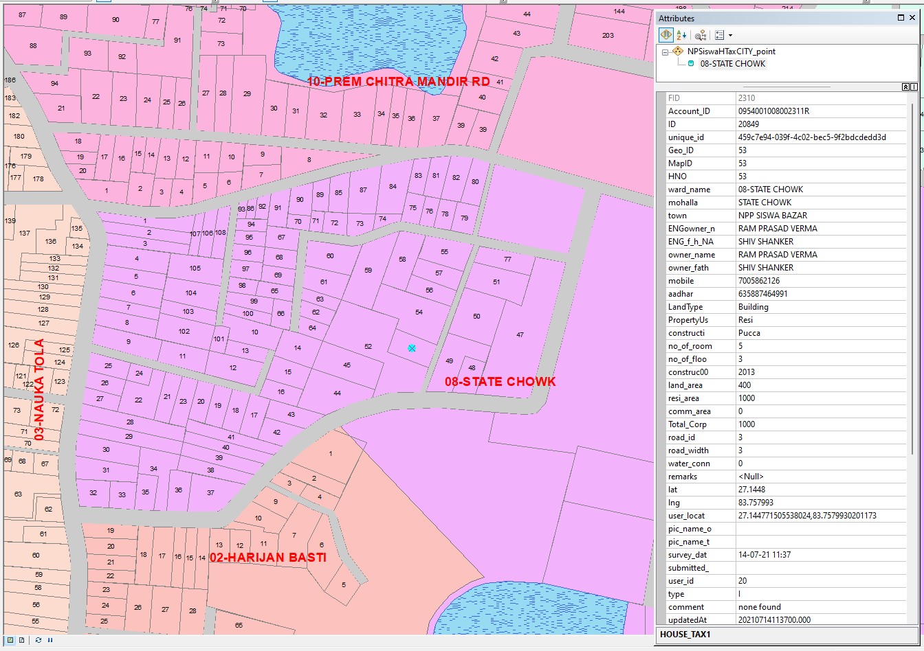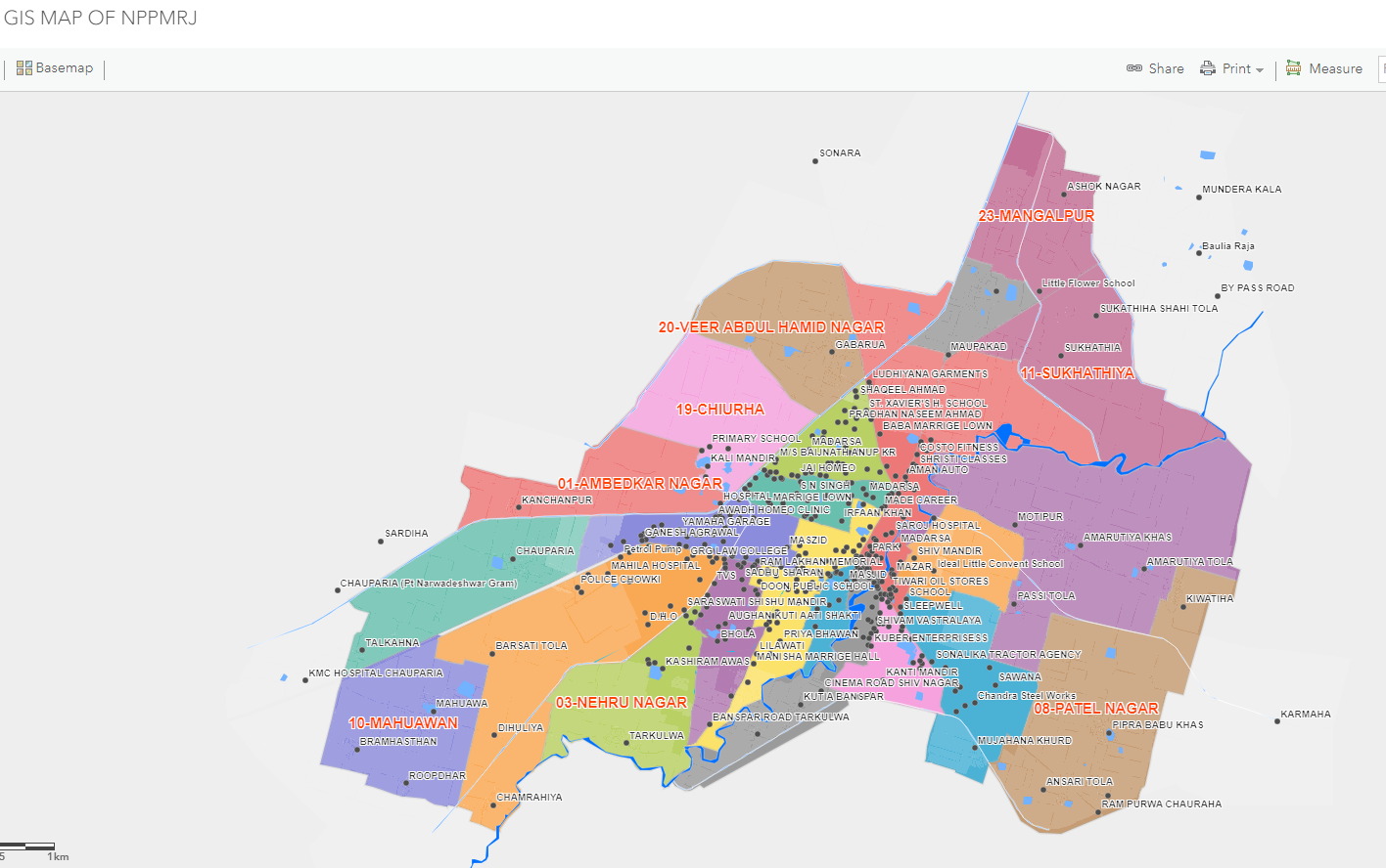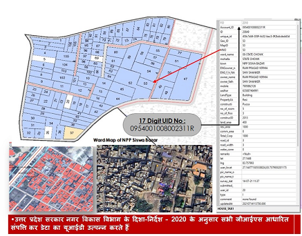
GIS (Geographic Information System) is a powerful technology that integrates software, data, and tools to view, analyze, manage, and visualize geographical information. It transforms raw location-based data into insightful maps, charts, and reports—making complex data easy to understand.
GIS enables users to:
Search and analyze geographic areas
Edit and manage spatial data
Create interactive visualizations that support better decisions
It helps turn data into answers—solving real-world problems through simple, intuitive visuals.
While GIS provides high-precision systems integration and spatial analysis, land surveying offers detailed, on-ground data collection. When combined, they create a synergistic approach that optimizes both digital mapping and physical land assessment.