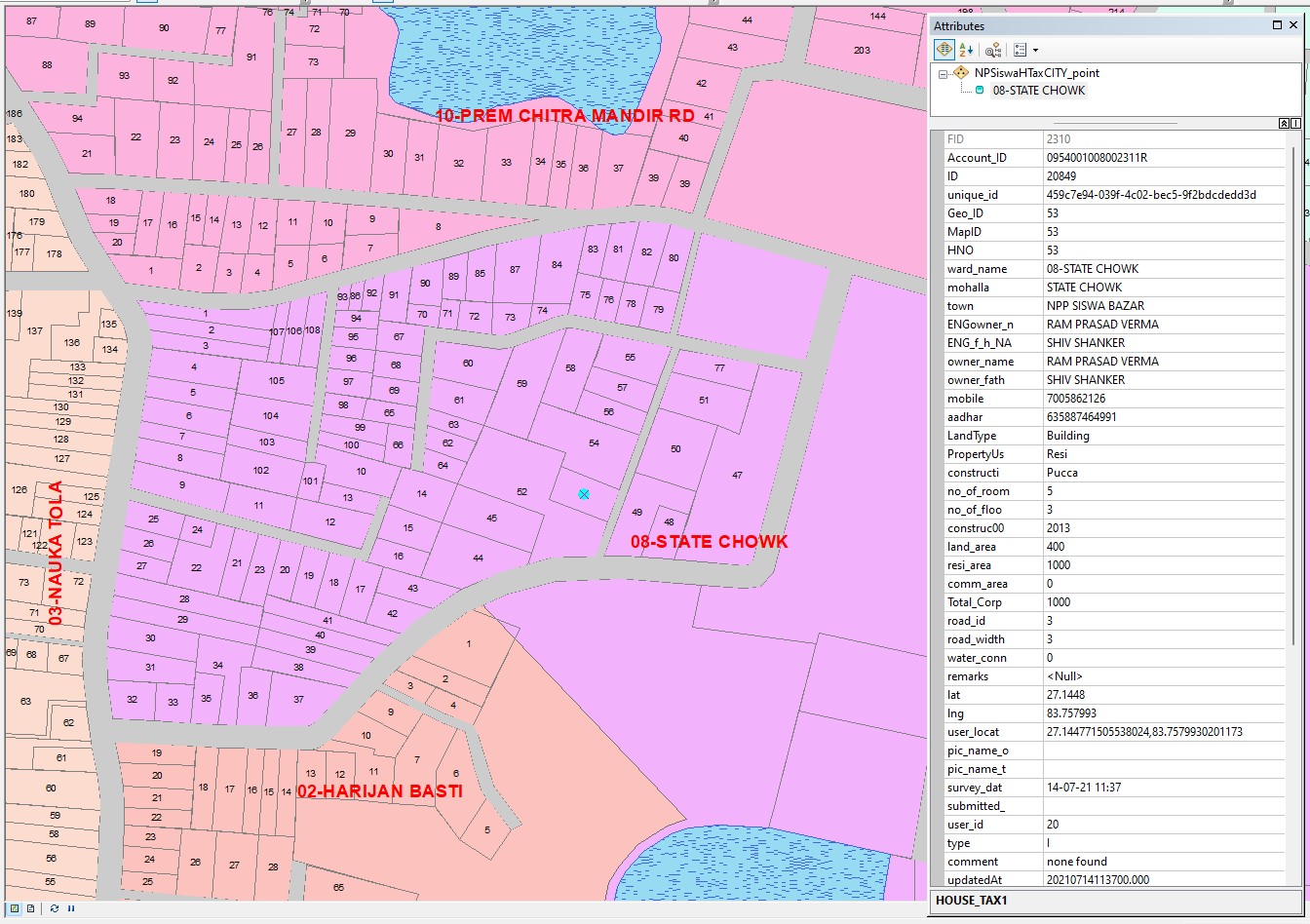
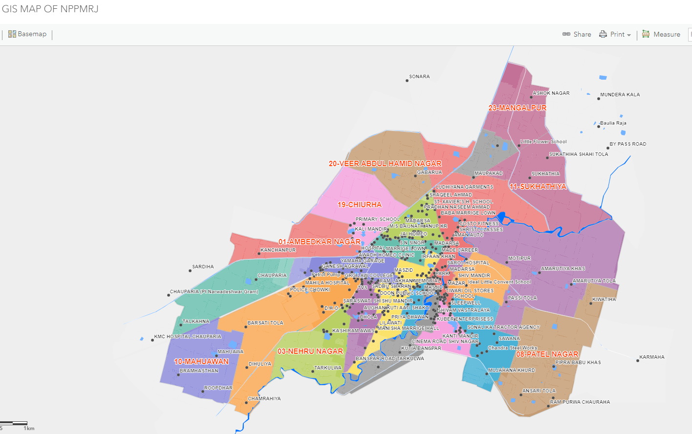
In today’s digital age, GIS-powered document management is transforming how we handle spatial data. Imagine clicking on a map and instantly accessing land records, ownership deeds, mutation orders, tax receipts, and more—all securely linked to the exact location. This smart integration not only boosts accuracy and transparency but also speeds up decisions and eliminates errors. Whether it's for urban planning, property assessments, or infrastructure projects, having documents geo-tagged ensures legal clarity, real-time access, and seamless governance. With GIS, data becomes more than just visual—it becomes actionable, trustworthy, and powerful for both authorities and citizens.
Link your maps with meaning. Attach land records, deeds & approvals directly to locations.
No more digging through files. Access documents instantly with a single map click.
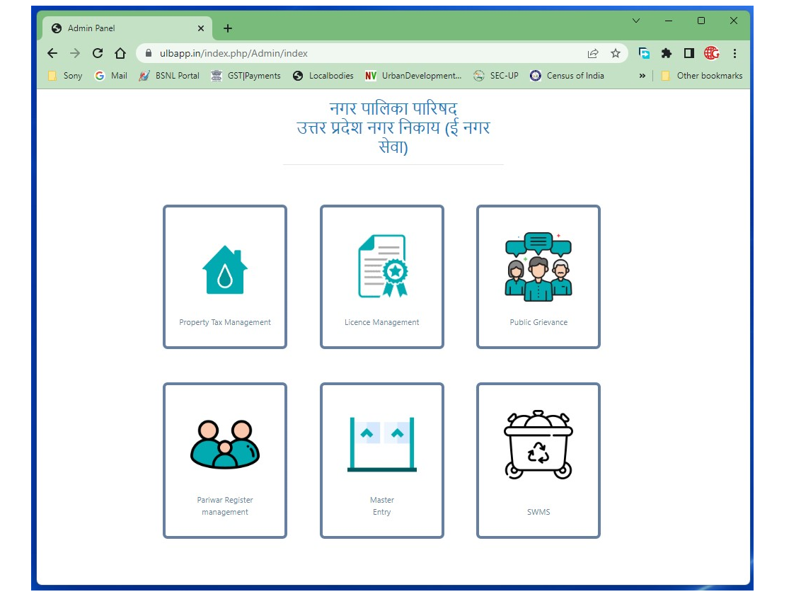
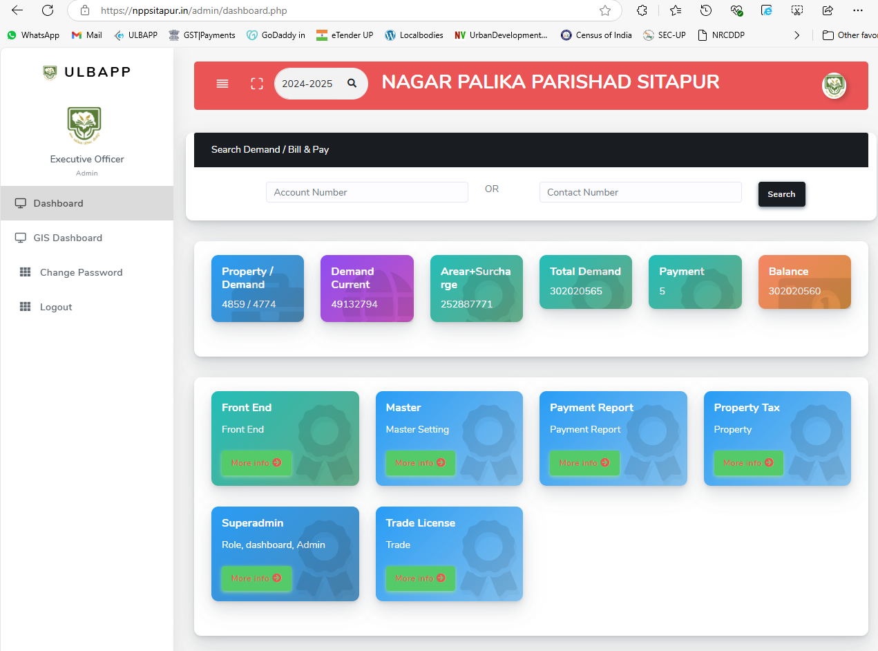
Seamlessly manage everything. Property papers, tax receipts, survey data & more in one place.
Make smarter decisions. Use verified documents tied to real-time spatial data.
Speed up approvals. Reduce errors with geo-tagged document access.
Keep your data safe. Enjoy secure storage with role-based access control.
Go fully digital. Eliminate paperwork and embrace a streamlined GIS document system.
Access everything instantly. From mutation orders to ownership history & regulatory files.
Empower local governance. Enable municipalities with efficient, transparent record management.
GIS + Document Integration = Smart Governance. Simplified, secure, and seamless.